Drainage Map Surveys in Runcorn
Enquire Today For A Free No Obligation Quote
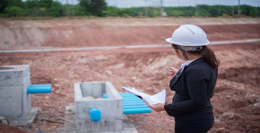
At Drainage Map Surveys, we deliver professional drainage mapping services for residential, commercial, and industrial properties in Runcorn and across the UK.
Our surveys accurately locate and chart underground drainage systems without the need for excavation, helping developers, architects, and property owners make well-informed decisions.
Whether you’re applying for planning permission, preparing a site for construction, or investigating a drainage issue, our drainage map surveys provide clear, reliable data supported by the latest non-invasive technology.
Why Is a Drainage Map Survey Essential for Properties in or Around Runcorn?
In Runcorn, drainage map surveys are vital for any site requiring accurate drainage intelligence for planning, compliance, or risk management.
Mapping is especially critical prior to development, renovation, or infrastructure upgrades—preventing costly errors caused by damaging or misidentifying existing pipework.
Which Types of Properties Across Runcorn Require Detailed Drainage Mapping?
We conduct drainage map surveys in Runcorn for a broad range of property types where precise drainage layouts are necessary, including:
- Construction sites and redevelopment zones – To inform designs, manage utilities, and meet planning requirements.
- Residential estates and new builds – For verifying pipe layouts, checking connections, and demonstrating Building Regulation compliance.
- Educational facilities – Supporting safety assessments and facility upgrades.
- Commercial buildings and offices – Assisting with layout changes, refurbishments, and asset management.
- Industrial sites and warehouses – Mapping complex drainage infrastructure to manage risk and ensure regulatory alignment.
- Renovation projects – Confirming existing pipe runs and service connections before work begins.
How Much Does a Drainage Map Survey Cost in the Runcorn Area?
The cost of a drainage map survey in Runcorn ranges from £350 to over £1,000, depending on property size, complexity, and required output.
Key cost drivers include the number of manholes, access points, the use of GPS or CAD outputs, and optional add-ons like CCTV footage, condition grading, or asset tagging.
Contact Drainage Map Surveys in Cheshire to get a tailored quote for drainage mapping at your site.
Can You Map Underground Drainage Systems Without Excavation Near Runcorn?
All of our drainage map surveys in Runcorn are carried out using non-invasive techniques such as CCTV inspection, sonde tracing, and GPS positioning.
This allows us to trace pipework, confirm connections, and produce accurate layouts without disturbing the surface. We access manholes, rodding points, and inspection chambers—even in restricted or hard-to-reach locations.
Do Drainage Map Surveys in Runcorn Include Sewer, Surface, and Foul Water Identification?
Our drainage map surveys in Runcorn differentiate between surface water drains, foul drains, and combined systems.
This is essential for both environmental compliance and to meet planning or building control regulations. We also document soakaways, interceptors, discharge points, and manhole details to provide a full drainage overview.
How Long Does a Drainage Survey Take to Complete for Sites Around Runcorn?
For a typical domestic property in Runcorn, drainage map surveys can be completed within half a day.
Larger or multi-building sites may take 1–2 days, depending on the number of access points and system complexity. Full survey reports, including annotated plans and recommendations, are usually delivered within 2 to 3 working days.
Are Drainage Mapping Reports in Runcorn Suitable for Planning and Building Control Applications?
Our drainage map survey reports in Runcorn are formatted for submission to building control officers, planning departments, utility companies, and insurers.
Reports contain detailed pipe layouts, invert levels, flow direction, pipe materials, and access point data. GIS or CAD files are available to support integration into design and engineering workflows.
What Technology Is Used for Accurate Drainage Mapping Within Runcorn?
We utilise the latest technology in Runcorn to carry out drainage map surveys with high accuracy, including:
- CCTV drain cameras – For internal condition inspections and route tracking.
- Electromagnetic locators – To trace pipe positions from above ground.
- Sonde tracing units – Inserted into pipes to determine layout, direction, and depth.
- GPS data collection – For georeferencing drainage components on larger or open sites.
- CAD software – Used to generate precise and professional drainage plans suitable for compliance and project use.
How Do Surveyors in Runcorn Ensure Accuracy in Confined or Obstructed Drainage Systems?
To ensure full coverage of even difficult-to-access systems in Runcorn, we use high-definition push-rod and crawler CCTV systems.
Where a single access point isn’t enough, we conduct multi-entry tracing to complete the route mapping. In confined or deep spaces, we follow safe-entry procedures, including tripod access, gas monitoring, and certified confined space operations.
Contact Drainage Map Surveys to book a consultation or site visit in Runcorn.
Find More Info
Make sure you contact us today for a number of great drainage map surveys services in Runcorn.
For more information on drainage map surveys in Runcorn WA7 1, fill in the contact form below to receive a free quote today.
★★★★★
“Excellent service from start to finish. The survey helped us plan our extension without any surprises underground.”
Mark Ellison
Cheshire
★★★★★
“The drainage map survey was incredibly detailed and easy to understand. It’s given us peace of mind knowing exactly where everything is located.”
Rachel Thornton
Cheshire